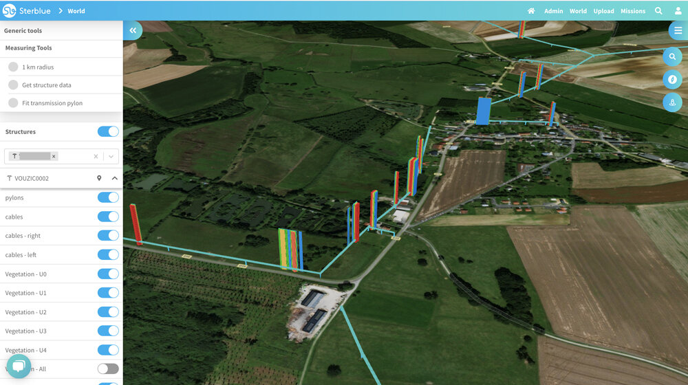
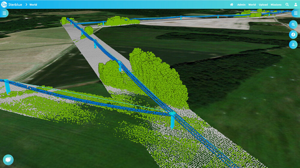
Assess vegetation around power lines with a combined approach using drone and satellite imagery
Feed your GIS with accurate and rich information about your distribution grid
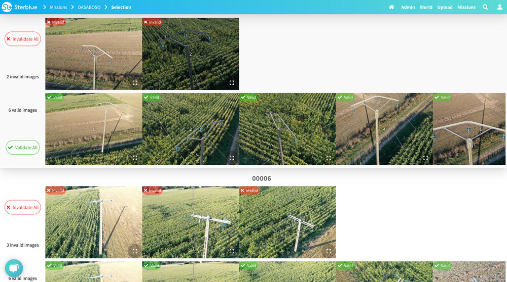
Perform an accurate and exhaustive assessment of your distribution grid
Access live reports for a faster response to incidents on your distribution network
Visualize a digital twin of your network to better take decisions